Tsunamis, Landslides and Asteroid Impacts: GeoClaw Models Deadly Flows

Around 9 p.m. on January 26, 1700, a catastrophic earthquake shook the Pacific Northwest. During the quake, estimated to be a titanic magnitude 9.0, the coastline dropped by several feet, triggering a series of devastating landslides that buried entire settlements. A tsunami then propagated outward, inundating villages along the American coast before traveling the expanse of the Pacific Basin to strike Japan, where written records describe how it destroyed coastal homes. An untold number of people died.
According to Alex Dolcimascolo, a tsunami geologist with the Washington Geological Survey, paleoseismic data stretching back 10,000 years suggest that these so-called megathrust earthquakes occur every 300 to 500 years in the region. Pressure builds over centuries as tectonic plates grind together, only to be released in sudden, catastrophic bursts. “It’s been quiet for the past 325 years, but we’re within that window now for one to happen again,” he says. “We can’t necessarily predict them, even though we know it’s a matter of when, and not if. But, fortunately, we do have better tools now to prepare.”
One of the most important tools in Dolcimascolo’s arsenal is an open-source software package called GeoClaw. Its creators built the platform to model geophysical phenomena such as tsunamis, storm surges and overland flooding. Modeling the fluid dynamics underpinning these complex geophysical flows can save lives. By simulating different earthquake scenarios and the tsunamis they generate, for instance, Dolcimascolo helped emergency management specialists in six Washington port towns develop response plans and mitigation strategies to outfit harbors to withstand tsunamis.
Dolcimascolo’s work joins a long list of projects that have leveraged GeoClaw to better understand and prepare for natural disasters. Today, Flatiron Institute researchers and their colleagues continue to update the software to better meet the needs of a robust community of users, including colleagues in academia, coastal residents, and federal and state agencies. As climate change reshapes the landscape of disaster preparedness, increasing the frequency and intensity of many of the phenomena GeoClaw is meant to model, its developers recognize the importance of open-source tools that allow researchers to draw meaningful conclusions from noisy data.
“The Flatiron is very supportive of developing software for the community, which is not always the case in academic math departments,” says Marsha Berger, an applied mathematician and group leader at the Flatiron Institute’s Center for Computational Mathematics (CCM) in New York City who helped develop GeoClaw. When she joined the CCM in January 2021, “it was this commitment to applying mathematical solutions to pressing issues that drew me in, even more than the access to powerful tools and resources.”
A Model for Simulating Catastrophe
GeoClaw is a spin-off of a larger software package called Clawpack, first developed by Randall LeVeque, an applied mathematician and professor emeritus at the University of Washington. While on sabbatical in the early 1990s, LeVeque began working on a modeling tool to teach students the basics of wave propagation.
Mathematicians model the behavior of waves by solving a series of tricky problems called differential equations that describe how a wave changes over time and space. To simplify these calculations, numericists often break waves down into discrete cells. Each cell has an associated depth and momentum at each slice of time and is affected by the behavior of the cells surrounding it. Their collective behavior allows scientists to calculate a wave’s propagation. Unlike with algebraic equations, there isn’t a single, universally applicable method to solve all differential equations, and this complexity can be a significant obstacle to modeling phenomena like natural disasters.
“I originally made it as a teaching tool, but then I found that I just kept using it in my own work,” LeVeque says. “A lot of people had been working on methods for these wave propagation problems, but there just wasn’t much software around that was relatively easy for people to get started with and that could adapt to new problems.”
LeVeque released Clawpack as an open-source program, and over the years, others have built atop it a series of related models tailored to specific use cases. GeoClaw, for example, began as the dissertation work of one of LeVeque’s doctoral students, David George, who was interested in modeling tsunamis. He originally dubbed the code TsunamiClaw before realizing that, in fact, the platform was widely useful across many types of geophysical flows.
“It turns out that these flows have a lot in common, and the equations we use for something like landslide modeling are actually pretty similar to the ones we use for tsunami modeling, which is surprising to some people,” says George, who is now a research mathematician with the U.S. Geological Survey (USGS), studying volcano-associated landslides at the Cascades Volcano Observatory in Vancouver, Washington. “In creating a very general set of simulation tools, people can do all kinds of different things with them, and so GeoClaw picked up a pretty dedicated user base early on.”
“It turns out that these flows have a lot in common, and the equations we use for something like landslide modeling are actually pretty similar to the ones we use for tsunami modeling.”
David George
GeoClaw is also unique among modeling platforms in its flexibility. While it’s possible to connect the platform to powerful computing infrastructure that can run multiple simulations in parallel, GeoClaw also functions perfectly well on a laptop. That flexibility makes it a valuable tool for individuals or smaller labs without access to expensive computing resources.
This adaptability stems from a computational technique known as adaptive mesh refinement (AMR), which helps focus computing power onto parts of the simulation needing higher resolution. When researchers model something like a transoceanic tsunami, drastic differences in scale often become an issue, says Berger, a pioneer of AMR who helped incorporate the method into GeoClaw. “On one hand, you’re looking at an entire ocean basin like the Pacific,” she says. “But within that, you may be interested in what’s happening around, say, one of the Hawaiian Islands.”
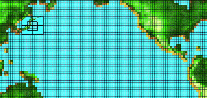
Mapping the entirety of the Pacific — which covers more than 30 percent of the Earth — at the same resolution as a single island would overwhelm even the most powerful models we have today. Instead, AMR overlays a nested grid atop a simulation and modifies the resolution within each cell as the simulation progresses. The open ocean might be modeled using cells that represent 100 kilometers, for example, while researchers might need a resolution closer to 10 meters to understand how a wave propagates as it hits the contours of a landmass and how that changes over time.
“What adaptive mesh refinement does is figure out where the solution is more complicated, which means it needs more points,” Berger says. “It seems simple in theory, but it’s computationally very tough in practice. A lot of hours and the sweat of many people have gone into making GeoClaw what it is today.”
Bringing Certainty to an Uncertain Future
Many of the natural disasters that GeoClaw allows scientists to study are projected to increase in frequency or intensity under climate change. Wildfire seasons have become progressively longer, for example, and fires are collectively causing more damage now than in years past, including an uptick in the number of post-fire landslides. And along the U.S. coastline, where 30 percent of the population lives, low-lying communities are increasingly threatened by rising sea levels and escalating storm surges.
Even natural events that don’t seem inherently linked to climate change can still be affected by it, says George. For example, as glaciers retreat, they often reveal steep and unstable slopes of sediment that heighten the risk of landslide tsunamis for coastal communities. These tsunamis don’t threaten as wide an area, but they often cause more localized damage where they do strike.
“Climate change impacts all these types of surface flow processes because generally, it’s making the surface of the Earth less stable,” George says. “It’s a hollow victory to say this, because I wish it wasn’t the case, but in some ways, climate change has made GeoClaw even more valuable as a tool.”
Meeting the disaster-preparedness needs of the future will require the collaboration of many different stakeholders, says Kyle Mandli, a project scientist at the National Science Foundation’s National Center for Atmospheric Research and a former research scientist at the Flatiron Institute. Mandli’s work today focuses on developing mathematical approaches to cataloging and responding to threats posed by climate change, meaning that he’s often collaborating with partners at federal and state agencies, academic institutions, insurance companies, and advocacy groups representing coastal residents. All these communities, he says, should have a say in how disasters are studied and prepared for.
“Fortunately, I think what people have recognized is that the climate change questions we want to ask are not possible without things like GeoClaw,” he says. “The science of answering a lot of these hypotheticals and doing that in a systematic way is new, and GeoClaw is a go-to tool for this.”
Bolstering Coastal Communities
The popularity of GeoClaw and the ease with which relative novices can pick it up mean that it continues to draw new users even decades after its initial release. LeVeque says that while he’s long since stopped tabulating all the people using GeoClaw, it’s likely a larger community than even he knows. More than 1,500 research publications have cited the program, and users and developers often connect through online forums. “It belongs to everybody now, and we all contribute to it,” he says.
Katherine Barnhart, an earth scientist at the USGS Geologic Hazards Science Center in Golden, Colorado, says she knew about GeoClaw’s reputation as a “successful, long-standing open source project” long before she joined George in developing another spin-off, called D-Claw, focused on flows made up of a large percentage of solid material. Today, she uses D-Claw to study post-fire debris flows — landslides that sometimes occur when heavy rain follows a fire. In January 2018, for example, a debris flow traveling at up to 15 miles an hour struck a hillside community in Montecito, California, killing at least 23 people, damaging or destroying more than 400 structures, and shutting down Highway 101 for several weeks.

Barnhart used data collected after the slide to compare the performance of three models, including D-Claw. Her findings confirmed that the models are largely successful at reproducing the behavior of the actual slide, and that they tend to be more sensitive to some variables, particularly flow volume, than others.
This type of confirmatory research, she says, is an essential step toward reducing uncertainty in the models and stress-testing them using real data ahead of true risk assessments. “It’s more of a grind, but there’s no getting around the fact that these are necessary and important steps we have to take to feel confident using these models ‘in the wild,’ if you will.”
Having confidence in GeoClaw’s abilities means that researchers have been able to use the program to carry out hazard assessments for coastal communities. In 2016, LeVeque consulted on a tsunami assessment analysis for the low-lying towns of Westport and Ocean Shores in Washington. “On these peninsulas, there’s really no way to evacuate if there’s an earthquake because you may only have 20 or 30 minutes before the big waves arrive,” he says. However, based on the results of their simulations, LeVeque and his collaborators helped engineers design the first vertical evacuation shelter in North America, as part of a new gymnasium at Ocosta Elementary School in Westport.
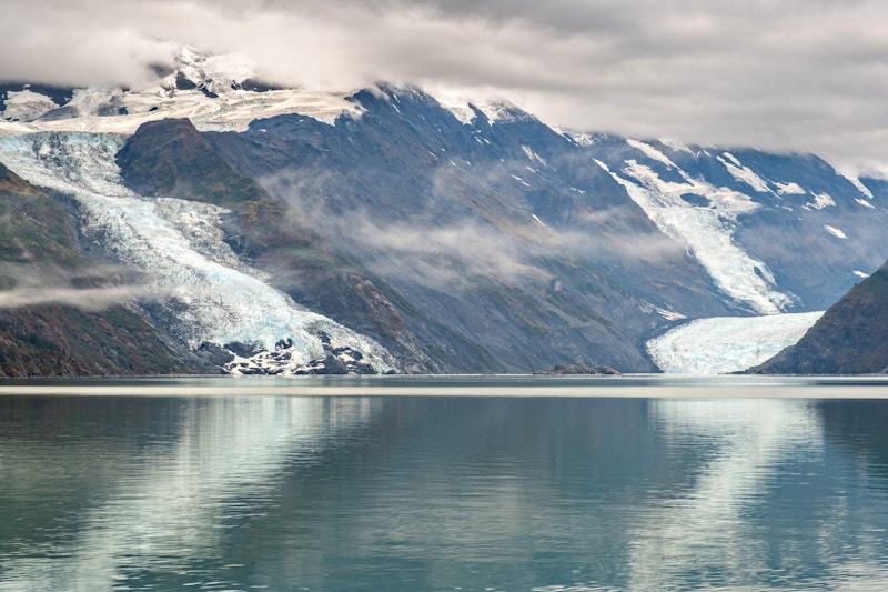
More recently, in 2020, Barnhart and George created new simulations associated with the Barry Arm landslide — an ongoing, intermittently active slide near Whittier, Alaska. As the Barry Glacier retreats, the slopes along the Barry Arm fjord have started to collapse. Over the last few years, the landslide has moved at variable rates of up to 2.7 inches per day. In the event of a total collapse, however, the resulting tsunami could pose a risk to the residents of Whittier, nearly all 270 of whom live in a single high-rise called the Begich Towers.
Fortunately, Barnhart and George found that due to the bathymetry of the newly mapped seafloor, the risk to Whittier was actually less severe than originally thought, although a slide could still trigger strong currents that pose a risk to ships nearer to the landslide. “Sometimes it feels a little doom and gloom in this line of work, so it’s nice when we get a happier result,” George says.
Today, GeoClaw continues to expand into new areas, even tackling threats stemming from the far reaches of space. Berger and LeVeque are now partnering with Michael Aftosmis, an aerospace engineer with NASA’s Asteroid Threat Assessment Project (ATAP), to study tsunamis linked to asteroids. When an asteroid enters the atmosphere, it can either pass through and strike the Earth’s surface or, more often, break up during entry. Both scenarios release energy that can trigger large waves in oceans and other large bodies of water.

The team has used GeoClaw to run simulations based on real events, including the appearance of a large meteor that generated a shock wave over Chelyabinsk, Russia, in 2013, as well as the eruption of Hunga Tonga–Hunga Haʻapai in Tonga in 2022, which Aftosmis says makes a good proxy for modeling the impact of a large asteroid. When the volcano erupted, it released a massive amount of energy into the atmosphere, triggering a pressure wave that circled the globe several times and caused many measurable tsunamis.
The ability to study, and hopefully preempt, future disasters lies at the heart of ATAP’s mission, and tools like GeoClaw have generally made it easier to develop accurate hazard assessments. “NASA has specific goals to advance the state of planetary defense, and this is one of the only natural disasters that we can plan for, accurately model, and hopefully mitigate,” Aftosmis says. “The ability to accomplish this mission stands on the shoulders of basic science and computational tools that have been in development for decades and relies upon engaging the expertise that exists across private and public institutions.”